Bottom Line:
Moderate Hazard (see the danger scale): primarily for deep, soft wind slabs in the fresh snow along ridges and near peaks – expect this problem to worsen through the day with increasing wind speeds along the upper elevations that might further develop existing wind slabs and will create new ones, possibly at much lower elevations. Also, be on the lookout for older, deeper, and denser slabs in isolated areas that are likely hidden by the fresh snow from Friday (diligence in locating and tracking this instability will be required if venturing into steeper and more exposed terrain). Finally, loose snow avalanches (sluffing) is likely in steeper terrain. This problem is very manageable if anticipated, and the snow likely to sluff is very light and not packing much punch.
Primary Concern:
The currently soft, deep wind slabs and wind pillows on the lee (wind loaded) aspects of ridges and peaks. This hazard is likely to worsen significantly through the day as wind speeds are forecast to increase well beyond the threshold required to move around the low density snow that’s out there. There is much new snow (5″ down low to well over a foot at the higher elevations) available for transport by the wind. The new snow is so light and fluffy that winds blowing in the mid-upper teens will likely be enough to exacerbate this problem. Winds speeds are currently forecast to reach 20-40 mph at the upper elevations today so expect decreased visibility due to blowing snow, as well as the rapid development of new wind slabs/pillows that will be possible at much lower elevations than they exist currently.
Secondary Concern:
Pockets of older, deeper, and denser wind slab exist in certain areas. Considering that where these slabs are dangerous they’re likely well hidden by a deep layer of fresh snow, you will need to poke around attentively to assess this instability. I would expect this problem to be most hazardous on steeper, wind loaded northerly aspects (like the North facing runs accessed via Arctic Valley and in couloir-like features elsewhere).
Mountain Weather:
Expect mostly cloudy skies, possibly with flurries this morning, with an increasing chance of snow as the day progresses. Mountain temperatures are likely to be in the lower 20’s. Winds are forecast to increase during the day, likely starting out in the teens and bumping up to 20-40 mph later in the day. Blowing snow, as a result of increasing wind speeds, will likely decrease visibility in the mountains (as well as contribute to instabilities as mentioned above).
Further Discussion:
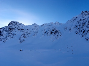
I was joined by a local backcountry strongman who equipped me with a pair of Verts in order to check out higher elevation, north facing terrain for the first part of the day on Friday:
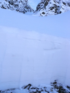
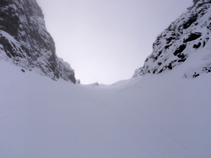
We found a frustratingly thin snowpack on normally deep aprons:
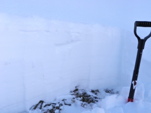
Each of us dug multiple quick pits with ST’s, CT’s, ECT’s, as well as many more handpits, throughout this couloir:
Mixed test results (ECT’s w/propagation to the climbers left of the couloir and ECTX’s along the climber’s right) and then sketchy handpits higher up turned us around before topping out:
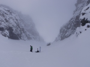
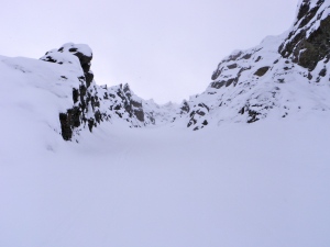
We had better luck in this, funner couloir – being able to top out and enjoy deep blower powder with a bit of a base in the couloir proper, but the apron was nothing but loosely consolidated snow on top of rocks:
Extreme caution is advised in this sort of terrain, especially at this time of year and considering the extremely thin and weak snopack. Travel in such terrain is not recommended without expert level stability assessment and decision-making skills. You also need to be able to accept a much higher level of risk.
After this journey into the higher elevation terrain of North Eagle River. I headed to the southern advisory zones to check out the Canyon Road area. Flattop and Peak 3 were heavily tracked by late afternoon/early evening, with no signs of instability other than sluffing in the steepest sections. I hiked the ridge from Peak 3 to Peak 4 and found, as usual, greatly varying snow depths. However, it is now skin-able the whole way. Some thinner windblown places sport a hard, rimey windboard. In other sections there is waist+ deep, soft, new, and wind-deposited snow. Some cracking was observed in the deeper wind pillows. Peak 4 was untracked. It sluffed heavily at the top, but was very manageable. It skied blissfully top to bottom. As always in the Front, watch for thin spots and lightly covered rocks.
Shout outs to Jess, Dr. Phil, Dr. Tony, Dave the Gnarly Noodler, and Randoman for their assistance thus far!

