
Weekend Avalanche Outlook
Issued at 11:15am. This is a general backcountry (recreational) avalanche advisory for Chugach State Park with the Front Range and South Fork Eagle River areas as the core advisory zones.
***There is still not much snow below 2500′ and thin snowpack hazard exists.***
Expect heightened avalanche conditions in Chugach State Park this weekend. Evaluate snow and terrain carefully; identify areas of concern. Natural avalanches are unlikely, but human triggered avalanches are possible. Small avalanches may be triggered in specific areas, and large avalanches in isolated areas.
The Tuesday morning snow event deposited more snow in town than it did in the mountains. Dust on crust was the general scene in both the Rabbit Creek and South Fork Eagle River areas. However, more snow fell Tuesday night and Thursday. Generally, a few to several inches of accumulation from this week exist in the alpine.
Temperatures increased significantly Thursday during the snowfall, creating “upside down” conditions within the new snow. This means denser, heavier snow on top of looser, weaker snow: a setup more conducive to instability and human triggered avalanches.
Avalanche Problems:
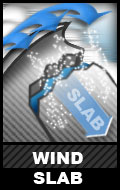
Winds picked up enough at times on Wednesday, Thursday, and Friday to wind load the ample loose snow available for transport into wind slabs that were already proving very sensitive and reactive to human triggers on Wednesday along the Peak 3-4 ridge. This problem is expected to have been exacerbated through Thursday and into Friday given the additional snowfall, “upside down” setup from the temperature increase, and more wind capable of loading leeward aspects and terrain features.
Expect touchy to stubborn human triggered wind slabs up to D2 in size to exist in the upper elevations (3000’+) on leeward aspects steeper than 35* (primarily southerly and westerly aspects, but the problem may also exist on other aspects due to terrain channeling of the primarily northerly and easterly recent winds).
Recent wind slab avalanches and cracking will be the primary red flags associated with this problem. Be skeptical of areas with deeper wind loaded snow, especially those that appear bulbous and/or have a hollow feel with moderately dense and punchy snow, near leeward ridges, peaks and cross-loaded upper elevation terrain features.
Much of the snow surface prior to this week’s snowfall consisted of firm and relatively low friction (potential bed) surfaces. Fresh wind slabs may overlie these relatively slick potential bed surfaces, and buried surface hoar and a thin layer of facets may exist in areas as a significant weak layer given that the first round of snow this week fell with little to no wind and possibly preserved these potential persistent weak layers.
Be mindful of terrain traps, and realize that even a small avalanche that could cause a fall or loss of control could have significant consequences in exposed terrain or if it took you for even a short ride through “cheese-grater” terrain that has a thin snowpack.
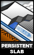
Generally stubborn human triggered persistent slab avalanches up to D2.5 in size are possible in isolated areas on terrain steeper than 35* in the upper elevations (3000’+). This problem may exist on all aspects, but is expected to be the most problematic in recently wind loaded areas where the weight of wind loading has added stress that will make deeper instabilities more reactive to a human trigger. Beware of steep upper elevation terrain that could produce wide propagation making for large and potentially deadly avalanches. Thin areas of the snowpack, where the weight of a human trigger can more easily penetrate to a buried persistent weak layer like the pervasive depth hoar near the ground, will be the most likely trigger points for a persistent slab avalanche.
This is a relatively low probability, but potentially very high consequence, hard slab avalanche problem.
Recent observations from Arctic Valley have shown that a potentially very dangerous snowpack setup exists on steep upper elevation terrain like the northerly aspects on Gordon Lyon. Classic northerly ski lines like the Ptarmigan S Couloir (which is also used to access classic alpine climbs) are expected to have the potential to produce deadly avalanches this weekend given a human trigger.
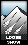
D1 human triggered sluffs are possible on upper elevation (3000’+) terrain steeper than 35* that harbors loose snow that has been sheltered from recent winds. While these sluffs won’t be big enough to bury a person, they could cause a loss of control with potentially dangerous consequences depending on the terrain.
![]()
Cornices are generally small this season given the meager snowfall, but they are expected to have grown this week due to the new snow and wind (potentially significantly especially in the upper most elevations). Don’t trust cornices. Give them a wide berth and keep in mind that a cornice fall could cause you to take a potentially dangerous fall and/or trigger an avalanche on the slope the cornice falls onto.
Mountain Weather:
Partly to mostly sunny skies with generally light winds and alpine temps in the teens.
__________
Many avalanche accidents that have happened in Anchorage’s backyard of Chugach State Park could have been prevented by basic avalanche awareness. You can start learning with some free online resources here. Getting avalanche education is a big part of recreating safely on the vast and wondrous public land in Alaska, and being able to enjoy the mountains during the snow season can greatly enhance your life. If you recreate on snowy terrain in the winter, make sure that you pursue avalanche education: a learning process that should never end…
Here are links to information on fatal avalanche accidents in Chugach State Park. You can learn from others’ mishaps.
__________
*click avalanche problem icons and hyperlinks for further info