
Low avalanche danger and excellent stability is expected to persist through the weekend as the weather remains clear, dry, and without significant wind.
Mountain Weather Update
Synopsis:
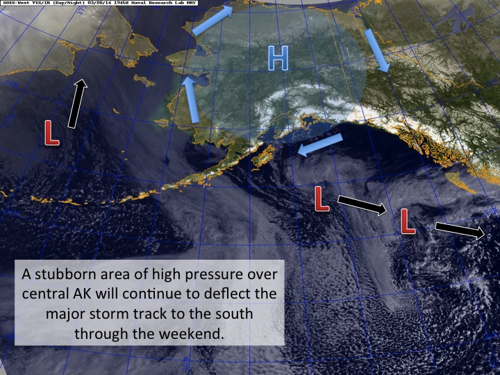
The main feature that has been effecting our weather has been a large blocking high pressure system centered over central AK. This will continue to divert the predominate storm track to the south prolonging the pattern of tranquil weather over the Anchorage area through the weekend. The high will begin to break down by early next week allowing an area of low pressure to nudge a little further north into south-central AK. Clouds will push into the advisory area by Tuesday afternoon and southeast winds will begin to pick up some in channeled and upper elevation areas. Precipitation from this system will remain on the other side of the Chugach to our south and east. The pattern looks to remain unsettled through the rest of next week but precipitation over the advisory area will be scarce at best.
Chugach Front Range – South Fork Eagle River area Forecast:
Daytime temps at trailhead elevations will start off around 20F and warm up into the mid 30’s in the afternoon. At upper elevations, temps will vary between 20-28F. Winds will be light and variable and skies will be mostly sunny to partly cloudy. After Tuesday, winds will begin to pickup out of the southeast to 20-30 mph at upper elevations and skies will be mostly cloudy to overcast.
It’s great to have our Mountain Meteorologist back! Please welcome Kyle back to AK from overseas duty.
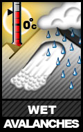
See last Saturday’s advisory, below, for a better idea of concerns. Wind slab issues have waned significantly but wet avalanche issues may increase slightly on south and west aspects later in the day. Pay attention to how saturated the snow is becoming; moistening, gloppy snow signals rising instability for wet avalanches.
Here’s an additional concern:
![]()
Click here to learn more about this type of problem and how to manage it
Solar aspect cornices are starting to cook in the intense Alaskan spring sunshine. Be mindful of how moist/wet/unstable they may become from midday on, primarily those that face south and west. Cornice falls pose an inherent threat, as well as their ability to trigger subsequent avalanches on the slopes they fall onto.
Saturday (3/22):
The danger rating and information provided below is only intended to be valid for 3/22/14
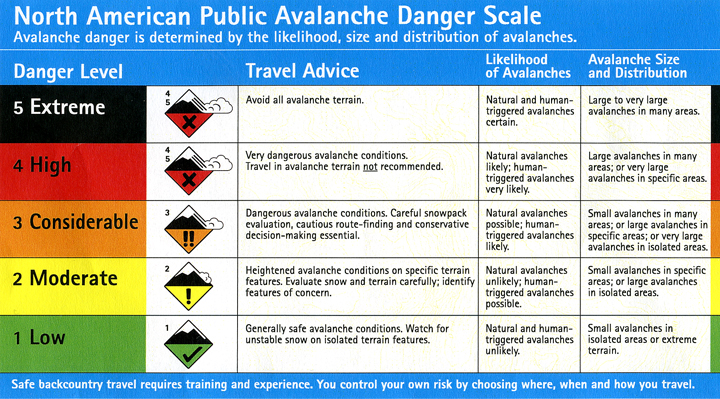
Click here to view the complete danger scale
Low danger does not mean no danger; unstable snow may be found in isolated areas.
Concerns:
Click here to learn more about this type of problem and how to manage it
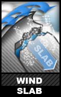
Lingering wind slab problems may still exist in the upper elevations (above 3500′), primarily in areas that have been leeward since last weekend’s storm near peaks and ridges, on cross-loaded terrain, and steep rollovers (convexities).
Be on the lookout for more obvious clues like pockets of snow that look relatively fat, bulbous, pillowy, or otherwise heavily loaded. Wind slab snow will also be relatively dense or hard and may have a hollow or punchy feel (denser, harder snow on top of looser, softer snow).
This long after significant snow or wind events the small wind slab problem will be more of a concern for knocking one over, rather than burial, so keep terrain consequences such as exposure in mind.
Click here to learn more about this type of problem and how to manage it
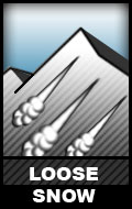
On upper elevation (above 3500′), steep, and wind-protected slopes (primarily northerly aspects) modest human triggered sluffs are possible. Again, these aren’t as much a threat due to burial but more so in terms of loss of control and terrain consequences.
Click here to learn more about this type of problem and how to manage it
Wet avalanche problems aren’t expected to be much of a concern, as warming and solar radiation have had little obvious effect on the snow so far this week besides creating some superficial crusts in isolated areas and melting out the thinnest areas of the snowpack, but are still worth mentioning in case warming and solar radiation reach more intense levels than what has previously been experienced so far this week…the temperatures have been gradually rising each day.
Later in the day south and west aspects, where the snowpack is thin and/or there are exposed rocks and tundra, will be the most suspect – primarily for loose wet avalanches (wet sluffs or point releases).
Mountain Weather:
Sunny with light, primarily northerly, winds and temps in the mid to upper 20s.