
Saturday & Sunday
Issued 1/24/14 @ 9:30pm
The Lowdown:
Snow and avalanche conditions this weekend will be very interesting, and seem to defy a single danger rating.
It seems to me that of the three elements that comprise a danger rating (travel advice, likelihood of avalanches, avalanche size and distribution) one is firmly considerable (travel advice), one is more characteristic of moderate (likelihood of avalanches), and one is borderline considerable–moderate (avalanche size and distribution).
That being said, the emphasis for this weekend is on the travel advice inherent in a danger rating of considerable: dangerous avalanche conditions (careful snowpack evaluation, cautious route-finding, and conservative decision-making essential).
Click here to see the complete danger scale
Concerns:
There are four avalanche concerns this weekend. However, due to the anomalous nature of current conditions, the concerns aren’t necessarily distinct and separate from one another; in ways they are interconnected.

Click here to learn more about this type of problem and how to manage it
In a dry snowpack, avalanches are typically caused by the strength vs. stress equilibrium tipping to the side of stress (being overloaded to the point of failure). However, other non-dry snowpack elements may contribute to the persistent slab problem this weekend: above freezing temperatures and rain climbed high into the mountains this week and it is hard to adequately know and understand their effects. Such elements characteristic of wet avalanche problems could significantly weaken and destabilize the snowpack, but an overnight refreeze will restrengthen it. Nonetheless, should upper elevations temperatures rise and remain above freezing again the snowpack will again be weakened and destabilized. While I wouldn’t expect this to create a specifically “wet avalanche” problem in the upper elevations (above ~3000′) it could contribute to lurking large, persistent slabs reaching the brink of failure. On top of the destabilizing effects of warm temperatures, rain (should it occur again up high) will have a further destabilizing effect. Winds (primarily from the southeast) have also been raging for over a week with little respite. All these factors are stressors to consider, where persistent slab problems remain (above ~3000′).
Click here to learn more about this type of problem and how to manage it
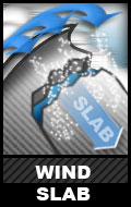
On Wednesday there was still snow available for transport by strong southeast winds as evidenced by pluming along ridges and near peaks in the South Fork Eagle River area. Small shooting cracks were also observed in wind loaded/deposited upper elevation areas (above ~3500′). A large cornice drop in North Bowl produced a deep (but short-running) shooting crack, but only small and short-running surface wind slab layers (~10-12″ deep) proved reactive with a jump off the cornice and ski cut. However, in terrain that is higher, steeper, or with a more sustained pitch such actions may result in larger more dangerous avalanches…that could also “step down” and trigger persistent slabs as they descend.
While rain has crept high into the mountains lately, recent snow in the upper elevations is a possibility. This recent snow would have been redistributed into wind slabs from strong southeast winds Thursday and Friday.
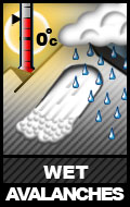
Click the following links to learn more about the two types of wet avalanche problems and how to manage them: wet slab avalanche, loose wet avalanche
In a wet snowpack, or snowpack becoming wet, avalanches are typically caused by the snowpack losing strength (versus being overloaded by stress as in a dry snowpack). As mentioned, avalanche problems this weekend are interconnected in some sense. Wet avalanche specific problems should be relegated to lower-mid to lower elevations (below ~3000′), but warm temperatures and rain (elements typically associated with wet avalanche problems) may contribute to other avalanche problems in mid to upper elevations (above ~3000′) as discussed.
![]()
Click here to learn more about this type of problem and how to manage it
Relentless winds (primarily from the southeast) for over a week have built cornices into large, hard, and looming masses. Relatively warm temperatures and rain have weakened these masses and made them more fragile. A cornice can pose a hazard in and of itself; it also has the potential to create a large avalanche as it fall on and “bombs” a slope below.
Mountain Weather:
Here’s an informative look at Alaskan weather the past week from the laudable Anchorage National Weather Service office:
And, here’s a Northern Hemisphere temperature model (showing our normally cold, wintry weather far to the southeast):
Unseasonably warm weather is forecast to continue for the foreseeable future. At least through the weekend, warm temperatures will continue to be accompanied by the relentless moderate to strong southeast winds that have been plaguing the Western Chugach for over a week. Somewhat of a pattern change should occur next week, but temperatures will likely remain well above normal – just with less wind and precipitation. Cross your fingers we at least get this lucky. Pray or do whatever metaphysical thing you’re into, that we are graced with an expedited return to winter!
Discussion:
Climate change: how are you liking it? Humans sure have done a number on this planet; it’s becoming increasingly obvious. If Earth were a democracy, the human species would have surely been voted out of power LONG ago – but the reign of the narcissistic totalitarian dictator continues…
The weather and its effects on the snowpack have been more typical of late April, than January, while the snowpack (depth wise) is more typical of December. However, we are still deep in winter without a lot of daylight and, thus, no intense effects from solar radiation.
The undesirable weather and conditions of late, combined with a busy work schedule (from my paying job that supports this grassroots, volunteer effort), has hampered field work this week – but I’ve still managed to get up into the upper elevations and assess the snowpack from trailheads to 4000′ ridges and peaks a couple times. My apologies for not posting observations, but my time and energy is limited. Please consider a tax-deductible donation (easiest via the Paypal link on the upper right hand side of the screen) to support this effort and help cover expenses, which are currently far from being met.
The Front Range and Eagle River area snowpack is a completely different animal than that of Hatcher Pass or the Eastern Turnagain Arm/Turnagain Pass area. I’d suspect it to be your best bet for alpine touring this weekend snow conditions and stability wise (I definitely wouldn’t waste the emissions driving north or south), but still needs to be approached with caution and respect.
On another note, driving to trailheads has been extremely treacherous this week! Consider this a warning…