
Advisory based on observational knowledge and weather forecast available at time of posting (12am). Accuracy is subject to temporal and spatial variability and expires in 24 hours. Read the disclaimer and conduct your own assessment of conditions accordingly.
Friday:

What you need to know:
While the avalanche danger is moderate, current snow conditions still demand careful evaluation in order to determine the specific avalanche concerns and danger level in the area in which you’re traveling. Dangerous avalanches conditions may still exist in certain areas, especially later in the day on slopes receiving the most solar radiation and warming (south to west aspects).
Danger trend:
Increasing through the day on warming, sun-exposed slopes. Otherwise, the danger is decreasing and stability is improving.
Primary Concerns:
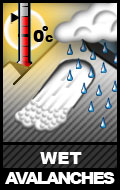
East aspects will warm and moisten first, followed by south, and then west aspects. Expect the danger to be the highest on south to west aspects later in the day (late afternoon to early evening). Warmed, moistened slopes (south to west aspects) will likely be susceptible to significant human triggered sluffing by afternoon.
Natural and human triggered sluffs have been observed to be widespread. The naturally occurring sluffing mainly took place on Monday and Tuesday, but human triggered sluffing will still be an issue to contend with on steep slopes – especially warmed and moistened south to west aspects late in the day where the sluffing snow will be relatively heavy and wet (packing more punch). Human triggered sluffing is still also likely on steep north facing terrain, but the snow here will pack less punch due to it being lighter, drier, and less consolidated.
Peripheral Concerns:
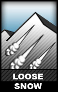
Numerous small natural and human triggered soft slabs have been observed throughout the advisory area. While this danger should be decreasing and stability improving, it’s a peripheral concern. None of the observed soft slabs have been large enough to even partially bury a person, but could prove more troublesome in exposed terrain as they have been large enough to sweep someone off their feet or funnel someone into a terrain trap. Warming and solar radiation may reactivate soft slabs on southwest to west aspects where they’ve been most sensitive (as we observed yesterday in the new human triggered Harp avalanche).

Although mountain winds have been relatively light some areas are loaded more heavily than others on varying aspects. Wind directions were different between the Saturday-Sunday storm and Monday-Tuesday storm. Between this and the channeling effect of terrain features, small and soft wind slabs may be found on all aspects in the upper elevations along ridge lines and near peaks.
Travel Advice:
Pay attention to the sun’s effect on the slopes. Look for rollerballs, point releases, sun induced sluffs, and other signs that the sun is significantly warming and decreasing stability on exposed slopes. As the new snow from Sat-Sun and Mon-Tues has not yet been exposed to that much warmth and solar radiation, when temperatures warm and solar radiation increases stability will decrease significantly and the wet avalanche danger will increase.
Be on the lookout for red flags of instability like recent avalanches, shooting cracks, collapsing or whumphing. What do these signs tell you about the stability in the area through which you’re traveling and how should you adjust your plans accordingly?
In assessing the wind slab concern, be on the lookout for some of the typical characteristics like a rounded, pillowy look and/or hollow, slabby feel. Wind slabs of concern will likely be in relatively obvious areas of deeper snow along ridge lines and near peaks.
Mountain Weather:
Friday is forecast to present us with mostly sunny skies, mountain temperatures in the lower 20s, and variable light winds.
Avalanche Outlook:
Saturday, April 13
Sunny skies and warmer temperatures are forecast. Wet avalanches will again be the primary concern later in the day as the slopes receiving the most solar radiation are warmed.
Sunday, April 14
Sunny skies again with increasingly warm temperatures will keep wet avalanches as the primary concern later in the day on the slopes receiving the most solar radiation.